Monday, July 23, 2018

Observatory Park, Night Ride to the...Clouds

On Saturday, July 21st, Mother Nature didn't cooperate with us for our planned trip to Observatory Park in Montville, Ohio. This is an official dark sky location, and part of the Geauga Park District. We didn't get to see the stars, but the clouds were gorgeous. First we rode to Orwell and ate at the A&W on Rt. 322. I should have gotten the mini corn dogs instead of the bacon chili cheese dog, but the chocolate shake was awesome!


If you like to see the stars at night, this is a super location. It's all set up for the gazer in all of us, and also has an education quality with a trail that details the different planets along the way. But first, you go down the long drive to a parking lot. From there you can see a couple of buildings: one houses a weather station, seismic station, and telescopes. The other is a gathering building with open restrooms (even when there are no events).


Upon reaching the commons area, you'll find a large sundial, and if it's sunny you can stand in a designated spot (read the instructions) and tell what time it is based on where your shadow falls. Pretty cool! And then beside that is a walk-around display showing the different phases of our moon.

Walk between the two main buildings and you'll see a huge metal globe with constellations all over it, and beyond that flowers and a huge field. On that field you'll begin to see stone effigies and a path to the right. Go that way! Initially, there are these semi-enclosed circles where you can learn about the planets while the sun, our very own star, sets, and have a seat to just listen to the wind or watch the sky. The entire path is long, but enjoyable as it winds it's way all around the huge field.


One of the reasons that it's so big is that the developers managed to place four large stone corners that mark the actual base dimensions of the huge pyramid in Giza, Egypt.


Goldilocks and I made it all the way to Uranus, which seemed like the path less taken considering the weeds that were taking hold of that circle. But it was worth it, walking closer to the woods and watching the lightning bugs come out. And not to mention the young couple that was setting up camp in front of one of the pyramid stones with a tent and all; it's a park so I guess you can do that (I was jealous!!!).

Goldilocks received a text message from Tiny that the guys were getting hammered by mosquitos, so we rounded the path back to the buildings and met with the guys back at the bikes.

We rode the dark roads back to 322 and took Rt. 45 south to 88, taking a break on the causeway at Mosquito Lake. It was windy, everyone wanted coffee or sleep by this time (11pm), so we headed back to Hubbard McDonald's. Bones, Booner, and Sweet-N-Low left for home so SNL could get 4 hours sleep before getting up for work! The rest went inside for coffee.


Take a look at the observatory's website to see the events that are put on year-round, and times for star gazing with the telescopes. We go from early morning sunrise rides to 14 hour day rides to night rides - because riding and being together is the best thing! Go make some memories.

~ Holly, a.k.a. Stitchblade

Sunday, July 8, 2018

Ohio's Tail of the Dragon, Route 536

Today was our 3rd Annual Sunrise Ride with our friends you are coming to know - Tiny and Goldilocks, Hammer, Bones, and Booner and Sweet-n-Low. You may recall that back in January, Bryon and I took a winter drive down Ohio Route 7 and checked out this dragon, and it was totally cool, cold even back six months ago. :)


I chose the Ohio Dragon for our Sunrise Ride, and by the way, if you have not done this, it's fun! We get up ridiculously early, 3am or so, and meet for breakfast at a 24 hour joint and try to hit the road at 4:30am. That worked in year one, not so much in year two, and this morning we didn't hit the road until about 5 or so, and the eastern clouds were already showing that cotton candy blue and pink. But that's okay.


We met at McDonald's in Hubbard. Did you know you can order bacon and eggs? True story.

Anyway, it was so freaking cold when we started riding through Hubbard on Route 7, but we're tough, and we followed 7 until we hit I-680 off of Albert Street. We followed that lovely piece of road to 224 and took that west to Route 7 South.

Route 7 is a nice road for quite a ways after you get south of Boardman. We stayed on 7 the entire way down to Hannibal, Ohio, stopping when necessary, like here. It was about 7:00am or so when we rolled all loud into this sleeping small town. I'm sure they were impressed, especially when we were so cold and I suggested a group hug to get warm. The guys thought us gals should go ahead and hug so our boobs would touch. Typical! Anyway, no hugging happened, and we took off after warming up by the engines.


Our next quick stop was a rest area 2 miles down 7 (if only we'd known), and then two town down aways we found a gas station. We stayed there for a half hour bullshitting and eating snacks. The guy working there was a biker too, and had a cool bike parked outside the building.


Onward we went, until Bryon saw a mom and pop restaurant on the right, Van Dyne's in Shadyside, so we made a right onto the road just past it and took the service road back to it. If you're in the mood for good food (biscuits and gravy sound good?), take a stop here. Oh, and they have a burger challenge, something like a 2 pound cheeseburger and fries in 30 minutes or less? Look it up here: Van Dyne's Restaurant.

It was only about another 20 miles to Ohio's Tail of the Dragon. You'll know you're close when:
1) you pass Ohio Route 78 on the right
2) you then pass a green sign that says Hannibal
3) you see the sign for 536 with the turning arrow

Turn right. You'll wind up a hill a ways by some houses, just follow through. Then you'll make a sharp left turn, up a hill, and a sharp right at the top and then have fun! It winds and turns and makes you think. Don't look too long down the drop offs or up the steep driveways that make you think "who the fuck would live up here?". Goldilocks counted the curves: 108. Ohio's Dragon ends at Ohio Route 78. You can go left to head west and choose other nice roads to ride, or turn right to go east and meet up with Route 7 again. 

Matter of fact, starting tomorrow, July 9th, they will be doing some much needed construction on some sharp bends that overlook deep slopes on Ohio's Dragon. In several places the road had collapsed and was restricted, and there were temporary traffic lights I think three times where there was only one lane. This kept us from going straight through, but it is supposed to be done in about 30 days. We recommend waiting until then to go do it.

On the way home, we rode back on Ohio Route 45 to Lisbon, and stopped for food at the Steel Trolley Diner for another bite to eat. I had the oatmeal pie, which was very good, and next time it will be one of their specialty hot dogs.

With that, it's 7:38pm, and I'm off to take a nap. That 3am alarm clock was a doozy, but it was worth every minute today to get up and do something different and make more amazing memories with the best of friends.

~ Holly, a.k.a., Stitchblade


Tuesday, July 3, 2018

Memory Patches and Vests

Memory Patches

In the biker world, when someone dies, they are memorialized on a vest or cut with a patch. The patches tell only the briefest parts of the person: their names, nicknames, dates of birth and death. 

The colors vary from personal favorites to club colors - whatever is relevant and shows a little more about their lives.

Here at our store, Freedom Thirteen Cycle, we created a memorial for bikers from the Mahoning and Shenango Valleys. We had a small banner made with a quote from a song, "We had joy, we had fun, we had seasons in the sun..." - so appropriate for the life of a biker. It doesn't matter how they died, and some didn't ride, but instead rode on the back seat sharing a life in the wind with their partners.


The idea came to me while reading the book, All The Names, by Jose Saramago. In this book, the main character, Jose, has been a basic clerk at the records department which records all the births, marriages, and deaths in a large city. It's a huge facility with aisles and aisles and shelves and shelves of dusty boxes of the dead. They contain all the names. Well, it was a really good book, and it struck me that I'm like Jose, day in and day out getting to record the names of the dead, only in my world in the form of memory patches.

I've seen many names of the dead. I've met their loved ones. I've touched their vests and made them a monument of sorts, a wearable record, a place for the dead to get yet another ride in the wind and sun.

Sometimes bikers come up with other ways to remember. In early 2017, a trucker/biker had come into the store with his brother's vest - the one he was wearing when he was in an accident on his bike and died. The trucker, Mr. Bevan, had been looking for someone who would be willing to make life-like wings out of denim on the back of his brother's vest (he had tried with some faded denim and markers, noting that his brother had gone down on his right side by using red in the lines). It was one of those rare challenges I accepted. For a week, I painstakingly created layers of denim with a feathery look, sewing down parts and leaving parts flip up, with the result pictured here. 


It's up to the living to remember the dead.
They do so in many ways.
Sometimes the living forget, or avoid what may be too painful.
However the living deal with death, there are no wrong ways, but as evidenced here,
the living do care.

So if you're reading this, keep on living.
If you choose to, keep on remembering. 
Most importantly:
have joy
have fun
have many wonderful seasons in the sun.


~ Holly, a.k.a. Stitchblade


Friday, June 29, 2018

Lake Chautauqua, NY

Sunday, June 24th, we went for it - a ride into New York to Mayville by Lake Chautauqua, just north of Jamestown. The forecast (as usual around here) called for a chance of rain at home and definitely up there.

So, we left Hermitage in the morning, around 9am I think, and headed out on State Route 62 out toward Sandy Lake. But I planned on riding Rt. 173 north so we stayed on 956 like going to Franklin, and that intersects with 173. North we went. And it got cloudier. And darker. An a few more roads and turns later we met up with a drizzle. Drizzle turned to rain, and slowed down our ride, but it didn't stop us. And across the state border into New York we rode.

What did stop us was when I came to a point (see way back in this photo in the upper left) where Route 408 turned right or kept going north. We pulled over on the road so I could be sure which direction to take - we were on the right path! The rest of the group took the opportunity to put on rain gear because riding in the cold rain in a t-shirt can kind of suck!


We don't take the Interstates on our rides. We kick back and stay out for 12-14 hours enjoying the adventure, as Bones like to do (adventure meaning getting a little lost and making random U-turns, etc.). One thing I do when leading is make up a route, but by no means stick to it if I see any problems, and when you're going where you've never been, that's just fine.

If you go the back roads, make your way to Corry, PA, which you can get to easily on State Route 6. Head north on Route 426, and make sure you have your helmet on because you'll reach the state line in no time. And by NO MEANS make a right turn onto State Line Road! Where it meets with 426 it's giant boulder-size gravel, I swear! That was the turn I needed to make, but no way; that's what I mean by being flexible. Follow 426 to Route 474 and turn right, and stay on 474 to the town of Panama, and turn left/north onto North Street. Stay on this road until you reach the T at Route 394 - turn left (which isn't easy) and you'll find restaurants, Boxcar Barney's, and a park. Then you can keep going and circle the lake back down to Jamestown.


We stopped at the Chautauqua Harbor House. It's a small-town diner with typical food, and decorated in a manor not found in big box restaurants. It's a unique experience. We ordered everything from crab cake sandwiches to fish sandwiches to meatloaf and mashed, to burgers and burgers and burgers!

We got lucky in that just before arriving in Mayville, the sky cleared and it never rained the entire time we were there, even though the weather called for 80% chance of rain.


Our next stop was at the park that is literally up the road on the right. It's a nice large park with a playground at one end, pavilions, and at the opposite end is a large open area with lots of benches for just sitting to enjoy the air and lake view. And that's what we did. After all that sitting, this was different; a breeze kicked up and the are was fresh. It was beautiful. 


At the bench end, away from the playing kids, there were interesting things to see, like this old car ferry that sits by the boat dock. It doesn't run. A group is trying to raise funds to repair it, and it's still sitting on the rail tracks to launch it into the water. 


I think we stayed here about 45 minutes. The sky was getting cloudier and darker from the north. Luckily, right across the street was Boxcar Barney's Ice Cream, so we mounted our horses and went over there. 


 Here we are eating ice cream. They had it all from cones to sundaes to floats and milkshakes. They also serve upscale organic food sandwiches if you're hungry for food too. 


No sooner were we done with the ice cream when you could see rain on the far side of the lake. We packed it up and hit the road back home. It took us about 4 1/2 hours to get there. Like I said, we don't ride fast and enjoy the ride and stopping to dilly dally. The trip home was good too. We got back to Corry and took Route 6 west and then kept following more familiar routes until we got back to Mercer. We stopped to bullshit at Country Fair, and then said our goodbyes, mounted the horses again and slowly peeled off to our relative homes. It was a great day! Even with riding in the rain, it was good, maybe even more enjoyable because it was different from fair weather riding. Anyway, here are more pictures from the park. Go check it out sometime.

~ Holly, a.k.a. Stitchblade


Monday, June 18, 2018

World Famous Horseshoe Curve


Sunday, June 17th, we rode out to the Horseshoe Curve in Altoona, Pennsylania. Big Meanie and me, Hammer and Bones, Tiny and Goldilocks, and that crazy bastard Tater Chip. What and where, you say? Well, we heard about it from Barry, a member of the V-Twin Cruisers; he was adamant that we had to check it out sometime.


The Horseshoe Curve was opened to east-west railroad traffic in 1854, so why hadn't we heard of it? Because it doesn't obviously impact our lives today like it did when it transported people as well as coal and goods. But there it still stands, a feat of human engineering, wrapping itself around a reservoir because it was not allowed to be constructed over the water which was the main source of drinking water for the local population.


Getting there is not too bad. From the west, we took Rt. 422 east until it hit Rt. 22, and then we were supposed to turn left onto Tunnel Hill Street. Yeah, right. There was no signage, so we missed it, and as the directional signs for Altoona faded, we found ourselves 19 miles too far east and had to turn around at a country crossroads. Having to stop twice or so to figure directions can feel like ten times. Taking Frankstown Road closer to Altoona, we stopped, regrouped, and gave directions to Goldilocks so that Tiny could lead us (Goldilocks was the only passenger, and much thanks to them for being able to read the road turns and get us there).

The Curve has two tracks so that trains can go in opposing directions (one is uphill, the other then downhill, with the downhill heading east because it had always been the direction from which coal from the west was delivered to the east). Upon arrival, there were indeed two trains running in each direction! And the visitor center sits in the pretty little valley amidst the curve of the tracks at the head of the reservoir.


We took a breather, then entered the shop and museum. It's $8 to get in, which includes the visit inside the museum and a ride on the small incline up the hill where visitors can sit track-side and wave at the train engineers and watch the cars go by. The engineers always blow the horns and wave; it reminds me of when my mom, dad, and I lived in Youngstown on Logan Way, and we would cross the tracks located between Logan and Albert Street - back then in the early 1970s, there were men who worked in the shacks up high by the railroad crossings. I was just two or three then and my dad would slow down so I could wave at the man who was working, and he'd always wave back smiling.

Inside the museum is a relief map of the area and historical information not only on the Horseshoe Curve tracks, but the significance they played in 1800s commerce in the United States, the competition for moving goods, and the hell that played out for the commercial businesses who had grown other transport businesses on the rivers and canals. There were rich men who built the tracks and related industries, and there were poor workers who did the dirty work. The end result was winners and losers among the task of moving the stuff of production.


You can walk up the hill too, and down. I chose to walk both ways, and if you do, there are souvenir pins in the shop to show you did it! Oh, and they also have other pins and you guessed it - PATCHES!  It's a really nice site, and worth supporting. If you get there early, you can purchase admission to both the Curve and the train museum located in Altoona, but it's a same day deal (I think).


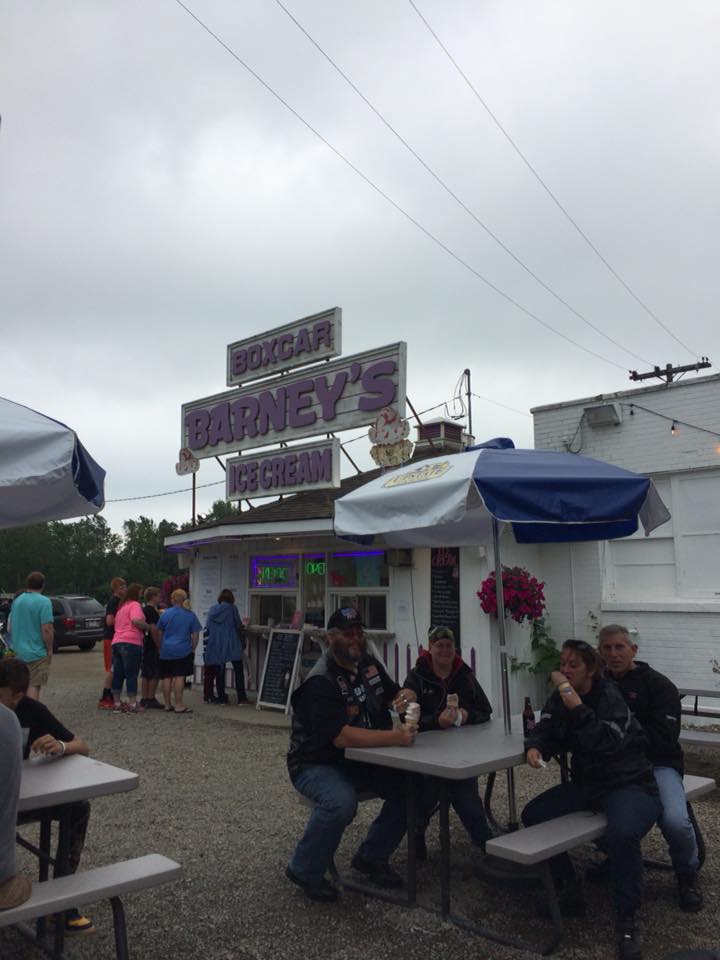
I haven't talked about food yet, so what kind of biker would I be if I didn't? We started off at Starbucks in Hermitage for a quick breakfast, then all along the way we snacked at every gas stop - Jimmy Stix, peanut butter whoopie pies, coconut whoopie pies, Mt. Dew, Mexican Mocha coffee, water, lemon pie, and who knows what else! But our main dinner objective was Smokin' Toads BBQ in Sarver, PA.


We had to get to Rt. 356 west. I had it all planned out, 22 back to 422, and south on Rt. 159 through Yellow Creek State Park. This went well. Then it was all out adventure from there! Part way into the park, there was an ambulance down by the water with the police - someone was hurt, and as we rounded the next bend, a fire truck blocked the road sideways. As we stopped, a life flight helicopter was coming in and landed to the left by the red truck pictured. After a few minutes, we were allowed to pass through.


To get to 356, we had to take Rt. 56 to Apollo, PA, but I wanted to take OLD Route 56. I saw one sign when we got to Homer City and was totally lost from there. I was leading on this return trip, so had to keep pulling the group over or into parking lots to look at the Google map. Ugh. But like Bones says, it's fun to get lost and good bonding time. After realizing that Old 56 was a no go, we went back north to 422 and found new 56, and that was a nice ride into Apollo. Then confusion again. We crossed the bridge that goes to the tracks that run in front of the old creepy hotel in the hillside. I new we were supposed to turn immediately after the tracks, but, well, that finally happened. That's a sharp right that immediate goes uphill, Orr Avenue. In a few minutes we were at 356 and headed north-isa.

Stopping for gas in Sarver, we were 2.4 miles from the BBQ joint, and made it there at 8pm (they closed at 9). I had called from the Curve to make sure they were open, and when we did get there late, they had a table all reserved for us and set for dinner!!! How about that? So we sat down, ordered, and boy, the coffee was a life saver for me and Hammer. I had the pulled pork mac-n-cheese bowl - delicious! Everyone else had some sort of meat from burgers to ribs to sausage. It was worth the time getting there and such a nice place with a very welcoming greeting from the owner and waitresses.

Well, go on out there sometime. Go anywhere! But check out these places when you can, and have fun. Here are a few more pics from the trip.

~ Holly, a.k.a. Switchblade

The big burger cowboy

A historic building track-side at the Curve

Trailers coming through on the train, with graffiti

Another sign

Me, Bones, and Hammer

Me and Bryon; with a DIRTY road face!
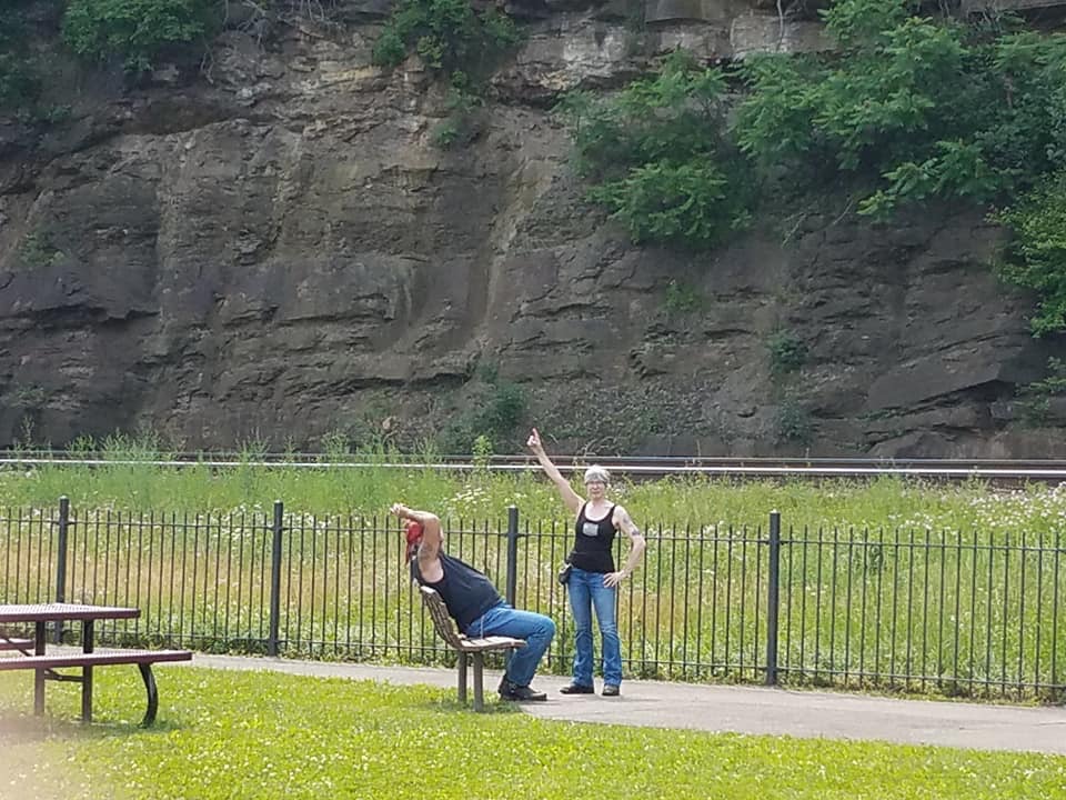
The breather

A rocky substrate by the tracks