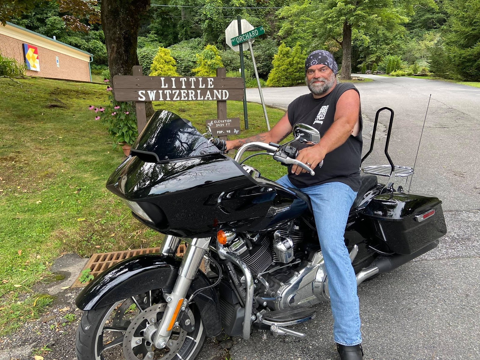
The Blue Ridge Mountains, there's no such thing as enough of that view. This is the view from our motel in Little Switzerland in August of 2021. But the story didn't begin there.

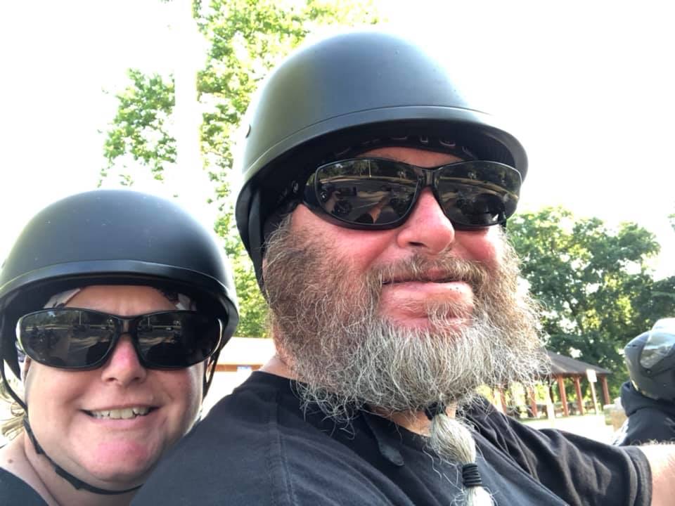
We take a trip every year come hell or high water. On this trip we met with A LOT of water, but not high enough to wade through. We got on our bikes and rode, we being me, Meanie, Booner, Sweet-n-Low, Goldilocks, and Tiny.
Before I go too far, Sweet-n-Low had broken her foot just days before the trip, but she is one hell of a woman! With foot in cast, she mounted Booner's bike for the whole week! So what if her foot started turning black, ya got to live for today, man! Kudo's to her.


We needed to go about 400 miles on that first day, and although we usually avoid interstates, we made our way to I-77 south after breakfast at C's Waffles in Hubbard. Interstates are boring. Here we are at one of our breaks along that road.

I-70 west was next, then exit 157 to follow US-22 west to Circleville, Ohio. From there we took US-23 south to Portsmouth. We stopped for pics with the neat bridge.


Crossing the bridge into Kentucky, we followed KY-8 west to KY-10 west, left onto KY-59 south, then west on KY-344, followed by KY-377 south, and then left on KY-32.


One of our main breaks was at the Brooklyn Belle Market located at 9335 Cranston Rd, Morehead, KY 40351. The people working there and the owner were all very nice, and it was a cool place to take a break and get some ice cream! They had recently installed a really cool mural of old license plates hoping that travelers would get pictures taken with it, so we did. And that made the owner happy! Check out their Facebook page here.


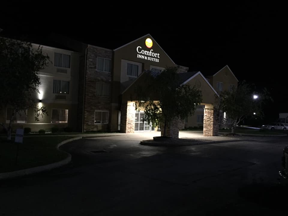
The sun was setting, and we didn't have hotel reservations, other than knowing we were near I-64, so we had to ride about another 23 miles to Mt. Sterling, Kentucky and stayed at a Comfort Inn.
The plan to get that far on day one was so when we got up in the morning, we would be as close as possible to the Red River Gorge Geological Area in the Daniel Boone National Forest, which was planned for day 2.
DAY 2:
So we got up and ate breakfast, and I rerouted us from the printed directions I had. Because we made it to Mt. Sterling, it was a simple two-road ride to the Gorge: US-460 east to KY-77 south. We stopped for picks with the Daniel Boone National Forest sign as we entered (not leaving as the sign says). Incidentally, Booner got his nickname from his first name being Daniel and someone calling him Daniel Boone! Great moment in time for a photo op.
 |
| Booner & Sweet-n-Low |

 |
| Goldilocks & Tiny |
Well, from there is was a GORGEOUS ride along KY-77 heading to the Nada Tunnel. It's all nature in these parts except for the well-paved road and traffic. The huge rock outcrops were really impressive and tall, which makes it all more impressive to ride through the tunnel. Whoa! It's one lane through, and it's dark, very dark, and as you approach, you have to stop very close to the entrance to be able to see and hear if someone is coming from the other end. But wow! It's all rough cut through and so amazing to be inside of a big rock! (But I love rocks, so there's that bias). Really, though, it was so cool, all I kept saying was, "Oh wow, oh wow, oh wow!!!" And I did honk my horn as is customary to do in tunnels.
If you have the chance to go, do it. You won't be sorry. And if you make the time, it's worth riding KY-715 which basically circles the Gorge area and has a lot of stopping points for trail access if you are into hiking. If you do ride 715, be cautious as a lot of the road has sink holes, and while a paved road, is often in need of repair due to the nature of the geological forces acting in that area.


We stopped to find food at the end of KY-715, and only found the ice cream/coffee shop, The Brick, open, but the boys needed food, manly food, not scones and tea! I did however get my coveted handmade coffee mug and a matching bowl at The Brick.

What happened next was not planned. As was the entire rest of the rip. Rain. Lots of rain, and randomly added between each destination, forced our hands to stop at points where we should have been passing through. For example, we left the Red River Gorge via KY-11 south, heading toward Oneida, Kentucky. The goal was to get to Tennessee and even boldly to Clingman's Dome! Nope.
The rain started holding us back early in the day, and there aren't a whole lot of places to just pull over, and definitely no shelter. But at one point, on KY-11 south, we hit rain and I saw a sign for Hill Top Pizza! Good enough for me, so I pulled us over and we were able to order pizza, subs, fried foods, burgers, drinks, and largely stay huddled and dry under their awning, plus there was a bench and tables to sit at between raindrops.


Time was ticking and we had to get going, so we took off in a misty drizzle. Then it rained again, and we stayed sweaty and warm in our rain gear, this next time pulling over into a car wash. Road trip tip: this was a great idea to stay dry. Then the rain stopped and we moved along. It didn't last long.
 |
| Thank goodness for self car wash bays |
As we rode KY-11 south, clouds rolled in, and it was getting necessary to find a gas station. Once location on the GPS ended up being a Dollar General, and as we sat there looking for the next station, the clouds got darker and heavier. I found a station a few miles away, put my phone in my Ram Mount, and started leading us that way. It started raining. But we were so close, so I kept leading, and then the rain started pouring, and we were getting blinded, but I kept rolling. Then my phone started getting wet, so I stopped dead nuts in the middle of the road in cold, drenching, suck-ass rain, only to realize that I was alone!!!
Where were my people? Did I go into the Twilight Zone? Was I still in Kentucky? Oh the rain, and cars coming from ahead and behind. A woman in a red SUV had stopped behind me and was giving me the time to go, but I kept waiving her on and then finally yelled back that I was waiting for my people. She hollered back, "They're under the bridge way back there", pointing behind her. LOL, you have to be shitting me?! I DIDN'T EVEN KNOW THEY STOPPED! The weather at that point just pissed me off, and so I put Poseidon in gear and went forward; there was no turning around where I was.
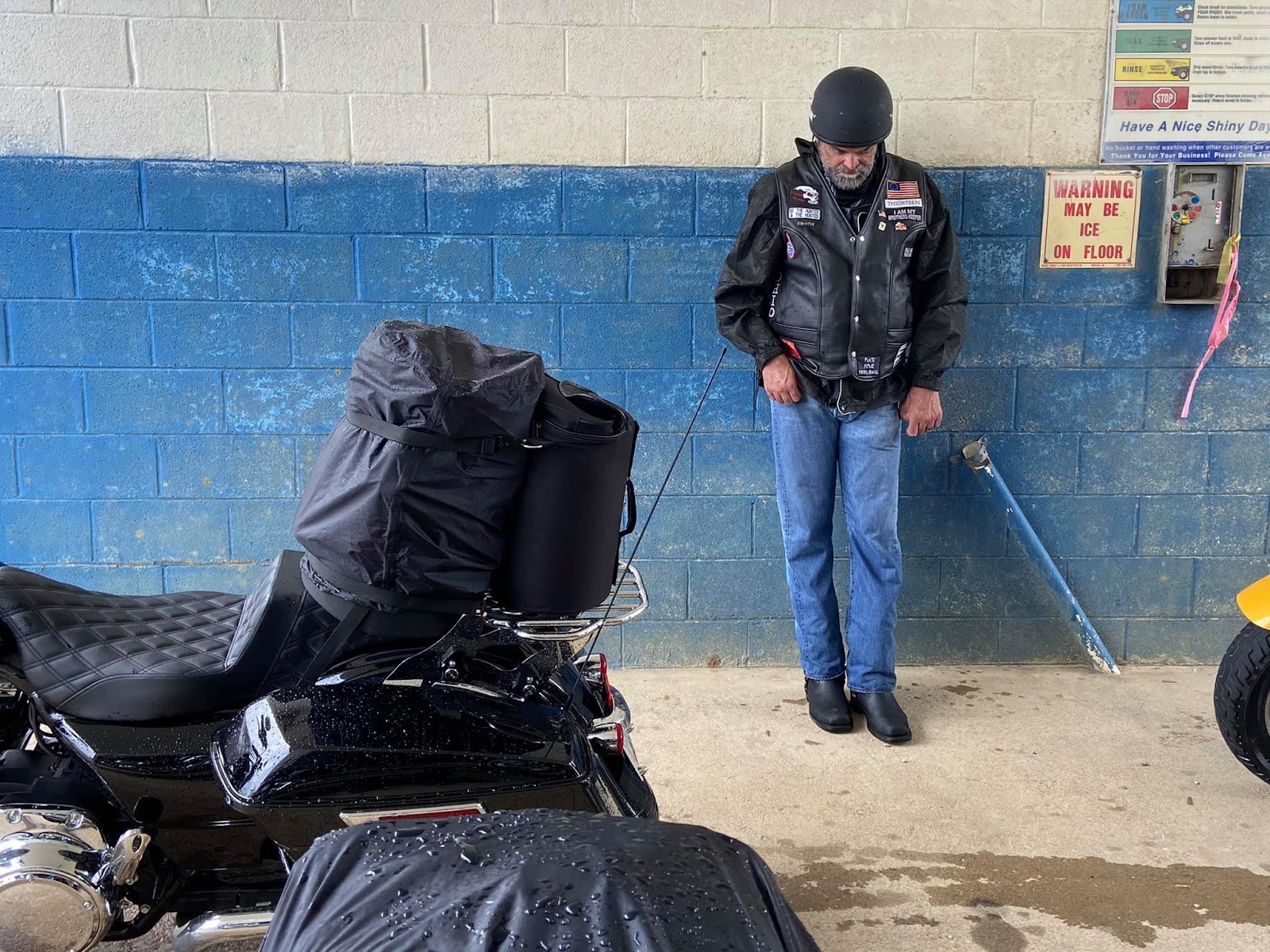
And that little jaunt sucked even more! I got to the end of the road as the map had shown, and it was suddenly a sharp downhill slope with a stop sign right at the bottom! Slippery than shit in a mudhole, I brought my bike to a stop, and had to sit in the rain waiting on traffic to pass on this now busy main road. I could see the gas station to the right - just past the tracks - the wet tracks that had diamond plate metal between the tracks and it was like crossing an icy pond. My back tire started to skid out to the right, but I was not going down, no way! I kept it upright and turned left into the station. And there I sat by myself for 1 1/2 hours by an out-of-order gas pump, waiting on my people to find me. The cellular service was hit and miss. And the bathroom inside the gas station was, well, read for yourself:

Meanwhile, my people were yucking it up under the overpass, drying off, and hopefully hoping that I was safe somewhere in America.


Then FINALLY - there they were, coming over the peak of that dang road with the hill. I had been able to warn them ahead of time about the hill, stop sign, and wet tracks. It was so good to see everyone again! The rain had not stopped, but got to a point where they could safely ride. We gathered at the pumps, fueled up, and then because it was now 7PM, it was decided to look for the nearest hotel. We were in Manchester, KY, and found a really nice hotel there, the Heritage Inn & Suites. After getting rooms and unloading the bikes, we walked over to the Huddle House restaurant and at a late meal. The rooms were excellent and the view of the cutout hillside across the road was really neat. Everything was so fresh and green.


Day 3, Tuesday:
Loaded up the bikes. The weather was dry, yet cool. We had to make it to Smokey Mountain Knifeworks in Tennessee to stay on some sort of schedule as we had a motel reservation for Thursday night. Stops we planned had to be tossed to the wind.
On KY-11 south again, we rode just fine to Barbourville, Kentucky to catch US-25E, following that to Pineville and south to the Cumberland Gap Tunnel. Now if you have not ridden that road before like us, once you get on the south side of the tunnel, there is AMPLE room on the right side of the road to pull over and take a photo with the now entering Tennessee sign; we didn't know that. But, Goldilocks managed to snap a photo while passing, so that had to do.

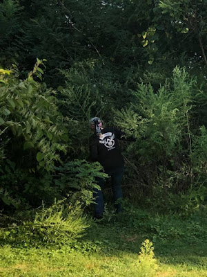
Along the way, Bryon suddenly pulled over, and the rest of us pulled over up ahead. We could see him park his bike and walk out into the road. He was rescuing a baby turtle from the perils of crossing a 4 lane highway! What a nice guy. He's no meanie. Here's what the critter looked like:

The weather had turned sunny and warm! It was getting old riding in the rain. So onward we went following US-25E to I-40/I-81. There we headed west on I-40, exiting at #407. First stop was Smokey Mountain Harley-Davidson. You turn right off the interstate to get there, and it's up on a weird hilly parking lot on the left.

Everyone got a shirt, and the guys got their regulars: shirts, poker chips, shot glasses, stickers. It was a nice store.
Next: Smokey Mountain Knifeworks. There is motorcycle parking by the main front entrance. This was a really neat place with really nice knives. They had a huge area set up displaying all types of vintage and antique knives and weaponry. I bought a Swiss Army knife for myself and one for Hammer, while Meanie and Tiny bought Buck auto knives. There were coffee and snack vendors outside, so we stopped for iced coffees and enjoyed the nice weather.


Our next destination was Cooter's Place in Pigeon Forge, named after a character on the Dukes of Hazard show, which was just a short distance down the road. It took a little doing to get the right intersection in that crazy effing traffic! I didn't know anything about Pigeon Forge except to pass through it. There are three lanes of traffic in each direction. It's a tourist trap. Ugh. We found Cooter's Place; it's in a plaza, and the General Lee out front was covered in a tarp, but one inside was available to view. And that store trapped us tourists like birds to suet! We couldn't resist all the cool t-shirts and stickers and patches, plus they have displays of vintage Dukes of Hazard toys and memorabilia. It was a cool place to stop.
 |
| Tiny at Cooter's |


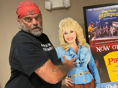
From there, we went right out of the parking lot over to Rocky Top Harley-Davidson for the coveted shirts and stuff. That was a nice store too. It sits right among a group of hotels and restaurants. As it was getting late again and we would not make it in time to Clingman's dome, we did NOT pass through Pigeon Forge, but instead found a Holiday Inn to stay at. It made for a nice evening. At the hotel, we unloaded and checked in, and Bryon and I took pics with the Dolly Parton cardboard cutout in the lobby.


Meanie and I took a walk that night to see everything lit up. It was pretty cool, and much quieter.


Day 4: Wednesday
Well the next morning came along, and we had breakfast at the hotel. We went down to the post office to mail souvenir's and dirty clothes home, then went back to pack the bikes. Next was to go to Gatlinburg to the Hillbilly Harley store, then on to Clingman's Dome.
We did what one can only do and follow US-441 south to Gatlinburg. Oh sure, there's the sign that says Gatlinburg Bypass, but then you can't get to Hillbilly Harley, so we just ignored the bypass. OMG, Gatlinburg is a four lane town with the traffic of eight lanes backed up in it. And HBHD was on the left side of the road, so we just waived as we walked our bikes by the store.

I had to ask a guy in a truck to let us in front of him so we wouldn't miss the only gas station in town. He was cool about it, so after killing our hands holding clutch and brake levers, we made it to the gas station, fueled, and left Gatlinburg behind, never to be seen again. That kind of stuff is not our cup of tea.
And immediately we hit rain! Luckily we didn't get poured on while in the standstill traffic. And the road out of Gatlinburg to Clingman's was really nice. We pulled over to get rain gear on and to clean glasses. The forest area was so beautiful and green.


We continued on, and the rain stopped and the sun came out, just in time for me to see some amazing mountains and a pull-off for viewing. It was the Chimney Tops area, where it looks like the mountains give off smoke, but it's long hole shafts in the rock letting off steam at the top. The pictures don't do it justice at all. Go there and see it.


Continuing on US-441, we quickly came upon The Loop, a 360 degree circle in the road that partly goes through a tunnel as the underpass. Meanie likes the sign because it looks like a hose clamp, and the ride on the circle feels like forever, but it's so cool!

A while later we turned right onto Clingman's Dome Road. This is a ways north of Cherokee, NC for reference if you have not been there. And again, a beautiful ride! Clingman's Dome Road takes you up and up in elevation along a beautiful winding road. At the end is a very full parking lot, so be patient if looking for parking. There is no motorcycle parking. The place was packed with people. The view from the base/parking lot is just as good as anywhere.


On that note, getting to the top where the observation deck it located is a tough walk all uphill on an asphalt path, at probably a 30 degree or more angle; it's no joke. I grabbed my blue rain jacket when I saw the clouds moving in, and we had to walk right towards it. Passing the souvenir and employee building, some of us started up. Sweet-n-Low couldn't with her broken foot, and Tiny tried but he would have been taken back down on a stretcher if he kept going, so he went back down to buy patches. Goldilocks, Meanie, and I continued on.


Then it started raining and everyone started hiding under the trees, going deeper into the woods. That worked for a while, but then the rain was so heavy that the trees no longer stopped it, and we stood under a tree getting soaked with freezing rain, well, I was pretty dry. Poor Goldilocks and Meanie; the cold rain would run down their backs and all they could do was laugh! And while we stood there people were still walking up and walking down. The best entertainment was when a group of young males were coming downhill, one of them running, and another shouting at him to stop running. Well son-of-a-bitch if the kid didn't biff out in front of us landing face first on the pavement and rolling onto a spike log!! We couldn't help but laugh, and with the rain and all, nobody left the safety of the dripping trees to help. He got up looking pretty embarrassed, and walked away.


Well, we decided not to go all the way to the top, and went back down to the lot. Everyone had been kicked out of the souvenir building when is started raining (they won't let you stay in there to keep dry), and there is NO shelter; the employees said to go wait in your car. Um, we're on motorcycles, so yeah, that doesn't help. Soooo...we hijacked some of the bathrooms! There is no other shelter there. And I heard one of the park rangers say it rains there every day, with maybe 7 days out of the entire year without rain. If you go, be prepared. Oh, and the lot floods at the low point where you circle to get out.


Soggy, we mounted our bikes and left taking that nice road back out to US-441 south to Cherokee. Boy, that was worse than the time we went there in 2018. There is no reason to go there, but that's my opinion. Even the tourist traps there had closed, and restaurants were lacking.
Because the weather had held us back so much, our idea of going to see the Georgia Guidestones was out the window, so we headed east on US-19 to Maggie Valley. There we sought out our favorite motel, Five Star Inn. When we were there in 2018, the man at registration was Chris Padgett, and at the time he was trying to buy the motel and live his dream of running his own place. The two ladies working the day we showed up - Chris' mother, and his female business partner - informed us that Chris had died from cancer since we had been there, but that he lived out his motel owner dream for a year.


We got our rooms and unpacked as usual. Then it was laundry time! Dirty laundry loaded back on the bikes, we rode down to the laundromat and spent about two hours there just hanging out. It was a simple evening and the town was quiet. We did end up going down the road to a plaza that had a candy shop open.


Day 5: Thursday
In the morning, we relaxed on the rockers at the motel. There is also a nice fire pit, gazebo, and swinging benches out on the front lawn with a lovely view of the mountains. We highly recommend this location for your visit to Maggie Valley and the surrounding area.


There is a place west of the motel called Joey's Pancakes, but we opted for Country Vittles, a really cool small place with everything you could want for breakfast. They serve food individually, or you can get the endless family style.


We had to wait outside for a table to open, and an old woman came out with a cane, and walked down the length of that blue fence in the picture, all the way to the end and took a hold of Meanie's arm and said he was going to help her to her car! Meanie's not the most approachable looking guy, so maybe she wanted the scary look to protect her on the way to her car. Who knows! So Meanie obliged and I was able to get one photo of the assistance he gave. Then she drove away, and we were called in to eat.

We had already loaded the bikes to leave town, so after breakfast, we went up the road to Maggie's Gift Shoppe; that's where I get all my cool tie-die MV tees. Oh, and fridge magnets.

With our destination for the night being Little Switzerland, we continued east on US-19 to US-74, exiting at #104; no that is a lie. I missed the exit and we had to make a long u-turn down the highway. Okay, so THEN we exited the highway for NC-209 - The Rattler.

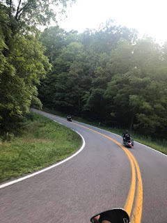
The Rattler is an awesome ride! It took us by surprise on the way down to Maggie Valley in 2018 when we entered it from the north end in Hot Springs, NC, heading the the Five Star Inn. It's about 25 miles with 250 curves. If you want Rattler t-shirts, then you have to stop at Ferguson Supply at the corner where you'll also find the huge photo op sign.


We finally got our shirts! There was no being Boonered on this trip (inside joke). Then onward to the curves and the beautiful sunny day ride.
Downshift, get through, power out of the turns, next curve, repeat.


When we got to Hot Springs, we pullover in a campground parking lot to take a breather. While there, a couple from Detroit stopped too. They had made it from Detroit to Maggie Valley in one day (the day before) via the interstates. We ended up having them ride along to the Bonnie & Clyde's restaurant for lunch following US-25 east.


After lunch, we continued east on US-25 to NC-213 north, then taking that to I-26. There our new friends parted ways heading south, while we headed north to exit 9. We continued from there on US-19W. I could see rain clouds now heading our way or us their way, but either way, we were going to get rained on again. At least we got through The Rattler dry. Just before we got under the clouds, I pulled us into a fire department parking lot, and we put on our rain gear. Then like good biker troopers, we forged ahead!
When you travel along US-19W, you will intersect with NC-80, which is known as the Devil's Whip. This elusive road was known to us on our first trip, but we bypassed it to get on the way home, so we were planning on riding it this time. More on that later. We passed by the NC-80 sign seeking NC-226 which is in the town of Spruce Pine. We turned right with our destination about 8 miles south. NC-226 intersects with the Blue Ridge Parkway, but that we passed continuing on NC-226A.
NC-226A is also known as the Diamondback. Gosh, it's such a nice area. We were on the lookout for the Alpine Inn, which I had picked from looking at Google Maps and liked its remoteness. As we came around so many curves, then one to the left, and then one to the right, it appeared like a diamond in the sky! We were excited right out of the gate! The owners, Ron and Susan, had reserved the flattest paved parking for our motorcycles since they knew we were coming. They are very motorcycle friendly. And the place was so colorful and full of flowers and well maintained, we knew it was a relaxing, caring place. That's why we vacation in the first place.


 |
| This is the lodge hang out room. You can buy snacks and coffee there anytime. |
As we got off of the bikes, Goldilocks was so happy that she came over to me smiling and said, "Good one, Holly!!!" Indeed, this was a good place. Forget the world, kickback. Rest. The owners greeted us, and we checked in at the motel office. There are three floors to the main building, with the top and middle having private balconies facing the Mountain View. Here is a picture of the room Meanie and I had. Some rooms have one bed, this corner room had two, dressed in beautiful quilts.

Goldilocks and Tiny were in the middle room. Once we took our boots off, and put on the flip-flops, Goldilocks and I took what may end up being a vacation tradition of snapping a pic of our flip-flop feet, this time from the third floor balconies! (This started during our 2020 trip).


Once we unloaded the bikes, we went out to relax in the outdoor seating, which has a fire pit and picnic table.
 |
| This is Ron, the owner, getting a fire started. |

Booner and Sweet-n-Low took off on their bike back toward Spruce Pine to hit the Wal-Mart for snacks. I asked for peanut M&Ms, and they also brought back chips and salsa, beer, and there were small bottles of some sort of alcohol. This was simply one of the nicest places we'd ever been. Had we known, we would have booked at least two nights, if not a whole week. You can get to so many places from this spot, and tour a huge area of the Blue Ridge Parkway.


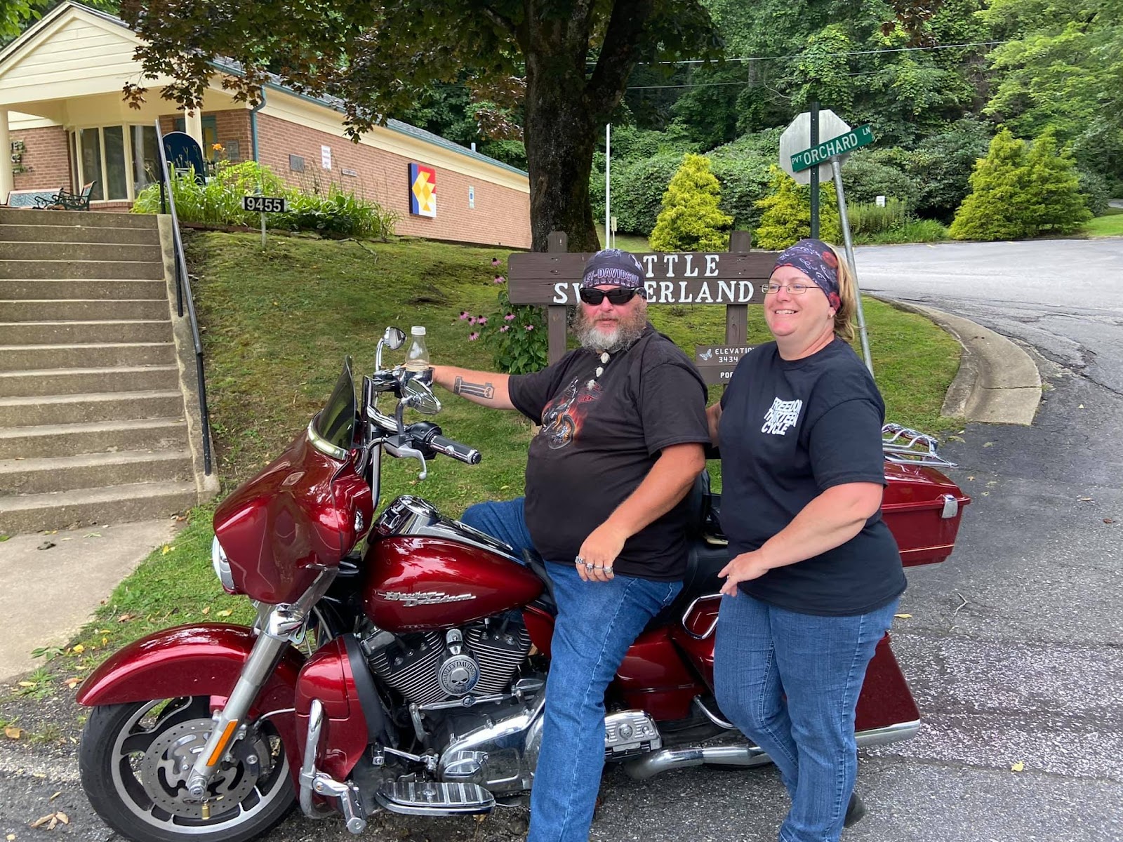
While the Booner's were out, the rest of us rode back up to the little town of Little Switzerland, but the stores were not open. We peeked in the windows and planned to come back in the morning.
Here are some more shots of the Alpine Inn:


The boys got hungry. It was already a bit late and dark out. They located a pizza place, I think Pizza Hut, back on NC-226, so Tiny and Meanie got on their bikes and rode those crazy curves in the dark back to town to pick up the pizza order. They had fun! I don't know, it seemed kind of scary to me, so I stayed and did nothing but eat peanut M&Ms. They made it back and everyone ate, then we retired to our rooms. Ron and Susan said the sunrise would be spectacular, and that it came early.
Morning arose.


 |
| Table Rock in the distance |


Ron and Susan offer breakfast in the morning, and you can choose quite a few items from their menu. They do not get into cooking bacon and sausage, so you'll just have to enjoy the healthy stuff - which was very good! Breakfast is served on the long outside balcony of the main building where you check in, so breakfast comes with a fantastic view plus visits by hummingbirds.


After breakfast, we gathered stuff to mail back home, and there is a post office right there in town. What we bought at the Switzerland General Store we shipped home too: souvenir tees, magnets, pins, patches - all that good biker collectible stuff!


And so began our Friday, day 6. We went back to the Alpine Inn, packed the bikes, thanked the owners for a lovely stay, and took off to tour the rest of NC-226A, the Diamondback. We took it south to get to US-221 south, which was to take us to US-70. We did that. The goal was to then take US-70 west to catch NC-80, the Devil's Whip, northbound. First I wanted us to stop for fuel, and I passed a few stations thinking, well I'll catch the next one. We finally stopped at a station that was further west of NC-80, and a good thing we did for two reasons:
First, while fueling, a police car had pulled in, and I believe it was Meanie or Tiny overheard the officer saying that a semi-truck had gotten stuck on NC-80, which is not designed for trucks. It was a great fortune for us to hear this or we would have been stuck on that remote, winding, high elevation road. We went back the way we came, going north on US-221 and then following NC-226 north toward the Blue Ridge and Spruce Pine. That is seriously a fun road to ride.
And second, we were barely half way along NC-226 when, you guessed it, stupid dark rain clouds rolled in. And it began to rain, then pour, and 226 is no straight shot by any means at all! So there we were, no rain gear because it had been so sunny and warm. Now we were wet and cold. We had to keep going to find a good pulloff site, and I found a second-hand store that had an abandoned "mining" attraction. We parked under a tree, which really didn't help.

The second-hand store was open, and we stood in that doorway trying to avoid the blowing rain. The mining attraction had the entrances kind of closed, but finally the women in the store told us we could sit under there to wait out the storm. I think we were there over an hour! Eventually the rain started coming in there too. We had some snacks, luckily. But we started getting hungry and located a joint north of the store.


 When the rain stopped, we got on the bikes and headed toward the sunny sky to CJ's BBQ. That was some good food, so if you go that way, get some grub at this independent business.
 They were nice people.


With the Devil's Whip cancellation and the delay with the rain, we did not get to ride some of the BRP as planned, so headed to our next destination, The Back Of The Dragon, Route 16. To get there, we found our way to US-19E and rode that north to I-81 East. We exited at Marion, Virginia, taking VA-16 north. Getting to Tazewell was the plan. At this juncture of the Back of the Dragon, there is a photo op if you want to park along the side of the busy road.
We did! And look at how sunny and nice it was outside!


STILL SUNNY! FUN ROAD! NOT FOR A BEGINNER.


WHAT'S THAT? RAIN CLOUDS? YA DON'T SAY?


THIS WAS BEAUTIFUL COUNTRY TO SEE!! SO REMOTE!


And then there was no denying that, oh please stop, that rain was coming. OH WOW! Good thing I had us pull over and put on rain gear because all hell broke loose and the fury of the Dragon unleashed and darkness descended upon us and the Earth and riding became unbearable!!! And that ain't no shit.
In total darkness, soaked, and still raining, we got to the intersection with US-19 in Tazewell, Virginia, and we made it to the Back of the Dragon store about a half hour before they closed (9pm). We parked and then they had such a nice outdoor seating area with a canopy, that we were able to hang our wet rain gear out to dry (ha ha!) while we went in to shop.


 |
| Tiny got his photo with the Dragon |
The
store and employees were very receptive. It's quite the place if you
have not been there. We were too wet to take advantage of their leather
seating, but they had great bathrooms, and food, snacks, and coffee.
Plus plenty of the souvenirs we craved! I had sewn on the patches that
customers had brought in, and now I had my own and totally fucking
earned them!


It was late, we were hungry, and the store closed. There was a hotel in town that some other customers said may have a room, but they didn't. The BOTD store offered us a number to call for their Air BNB, but that's some modern shit that sounded like a hostel where people get killed and have to share bathrooms, so thank you, but no. We ended up locating a Comfort Inn in Bluefield. But first we went to the local Pizza Hut, which was pretty nasty, and ate there anyway; not much to choose from.
Then we had to ride in the dark and yet more drizzling rain on US-460 eastbound to Bluefield, and checked ourselves in. We weren't the only bikers looking for shelter.

I don't know if I can speak for the others, but I had had enough of the rain. We were still having a great time, but you get tired of being wet and delayed. So with that, we ate at the hotel in the morning, loaded up, and all I cared about was getting as far north and away from the rain as possible. Plus I was tired of wearing a helmet, even if I do have cool stickers on it!

I had us follow US-460 east over to I-77 north, and we rode like lightning. My 650 V-star is a real trooper, and I can take him anywhere. Stitchblade is my name, and riding' Poseidon is my game! Okay, so we headed north, and the weather got better and better. We made great time too, And much farther north, we exited I-77 for a break where there was only one gas station with food and coffee. The restaurant part had photographs on the wall of all the people who were from there who served in the military. It was a nice idea and to see the names of those who loved America in times past.


We walked outside to get back on the bikes, when we ran into our good friends, Richard and Jeanne Young! Who would have thought that we'd see locals from Liberty, Ohio at a random gas station in West Virginia? They were on their way to Georgia. That was pretty cool!

Well, after that, we got back on the interstate toward home. It was already feeling like we should turn back and get more of a good thing, but life calls you home and you go. Along the way on Ohio Route 7 north, we stopped for a break when Booner said there was a ferry that takes you over to the WV side of the river, so we stopped there. It's in Fly, Ohio. But we were five minutes late; they closed at six. Next time.

Of course we made a special stop in Tiltonsville for our favorite pepperoni rolls at the Midei mart. It was getting dark, and colder.

And then we went home.
Hope you enjoyed this telling of our story!
For seven days we lived life.
We took on nature and won.
We bonded even more like people do when they endure together
and don't try to control each other and the events they experience.
You simply stay together and make memories, that's what friends do.
You cross each bridge when you get there.
~ Stitchblade (a.k.a. Holly)


Had such a great time. Aside from the rain would not of changed a thing. Well except maybe the broken foot lmao but was so worth the memories
ReplyDelete